


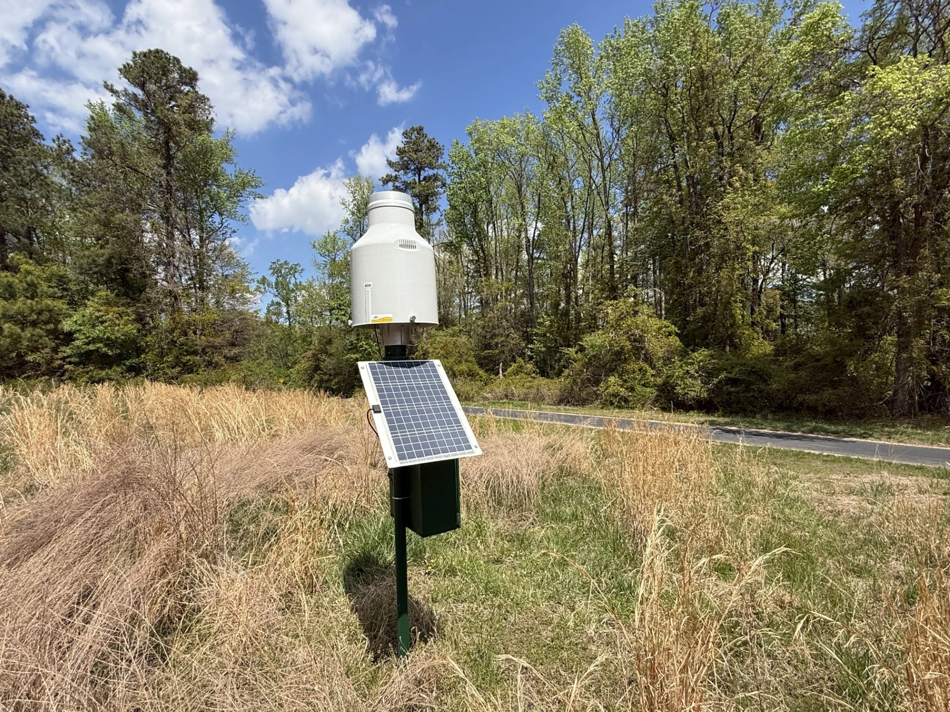
As you bike, run, or walk along the Virginia Capital Trail through Henrico County, you may notice small metal boxes, poles, or sensors. These are US Geological Survey (USGS) stream and rain gages. They may blend into the scenery, but they play a big role in keeping the Trail, nearby communities, and waterways safer.
What Do These Gages Do?
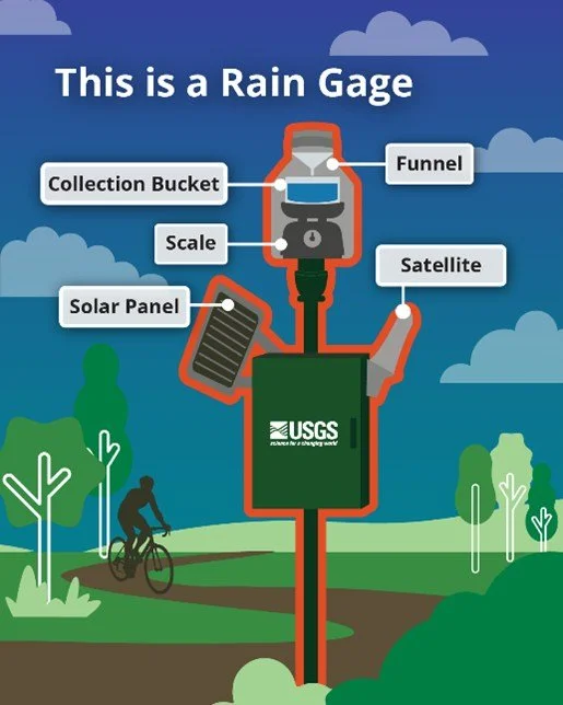
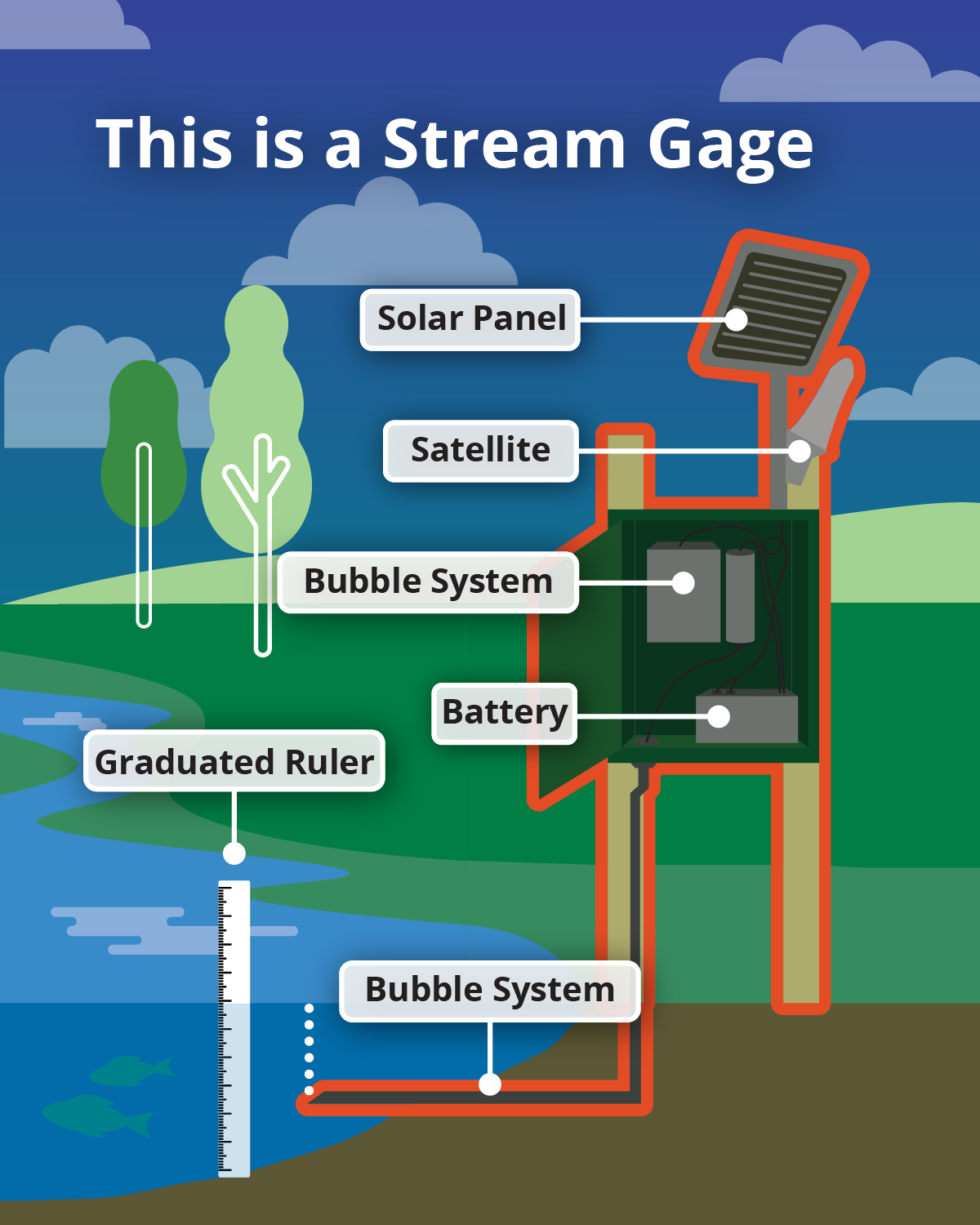
USGS gages measure rainfall amounts and water levels across Henrico County. This data is collected every 5 minutes and transmitted in real time. Because storms can change conditions quickly, continuous gage data provides early insight into rising water levels before flooding may be visible.
The gages provide valuable data for managing stormwater, preventing flooding, and maintaining healthy vegetation. This data is used by emergency managers, local officials, engineers, planners, and more to study trends and make decisions for the community.
Why Gages Matter to Trail Users
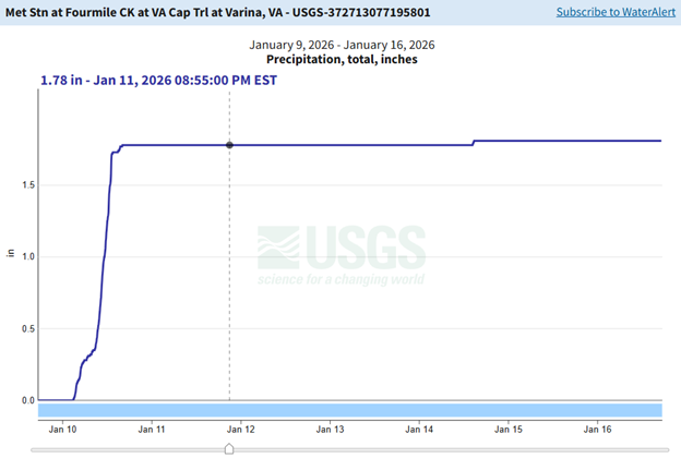
The data is not just for officials or technical staff; you can use it too! It is publicly available and accessible 24/7 to everyone. You can explore conditions by visiting the USGS webpage.
Here are some ways you can use gage data:
· Monitor flooding risks during and after heavy rain. During major rain events, gage data can show when water levels are rising rapidly, sometimes before flooding becomes visible.
· Inform decisions about trail conditions and road closures
· Support public safety for cyclists, pedestrians, and nearby neighborhoods
· Improve understanding of how storms affect local creeks and rivers near the trail
Sometimes the smallest pieces of infrastructure play some of the biggest roles in helping keep our communities informed and our shared spaces safer. Next time you pass a rain or stream gauge, remember that it is a vital tool helping protect people, property, and the natural resources that make the Virginia Capital Trail such a special place!
Explore the data anytime by visiting tinyurl.com/Henrico-USGS-Gages.
Written by Emily Mills and Marie Benavides
Henrico County Department of Public Works | Design Division